REVIEW · STELLENBOSCH
Jonkershoek Nature Reserve: Guided Panorama Trail Hike
Book on GetYourGuide →Operated by Aktiv Tours · Bookable on GetYourGuide
That 1,000 m climb is the real deal. I love the big panoramic mountain views and the way the trail swings from fynbos slopes to rocky cliff scenery. The one drawback: this is a proper workout, so if steep, rocky climbs scare you, you’ll feel it.
You start at the Jonkershoek Nature Reserve gate, then drive about 5 km on gravel before the first steep switchbacks. A good local guide, often in English or German (Dominic gets a lot of praise), keeps the pace safe and sustainable with regular stops and time for photos.
The trail is a 14 km circular route, usually around 5–6 hours, with wild viewpoints at every turn. Just plan your day around the elevation and bring enough water, because drinks and snacks are on you.
In This Review
- Key Points You Should Know Before You Go
- Entering Jonkershoek: Why This Hike Feels Like a Real Mountain Day
- Meeting at the Gate and Driving the 5 km Gravel Stretch
- The Rocky Gully Climb: Your 1,000 m Test of Grit
- High Ridges and Panoramas: Where Every Stop Feels Worth It
- Berg River Saddle and Assegaibos Kloof Valley Views
- Streams, Waterfalls, and When Swimwear Makes Sense
- The 14 km Circular Route: How to Think About Time and Effort
- Price and Value: What $112 Covers (and What It Doesn’t)
- What to Pack for This Strenuous Day Hike
- Who This Hike Fits Best (and Who Should Skip It)
- Should You Book This Guided Panorama Trail in Jonkershoek?
- FAQ
- How long is the Jonkershoek Panorama Trail hike?
- How far is the route and how much elevation gain is there?
- What group size is it, and what languages are the guides?
- Where do we meet, and is transport included?
- Is the entrance fee included?
- Are drinks and snacks included?
- What fitness level do I need?
Key Points You Should Know Before You Go
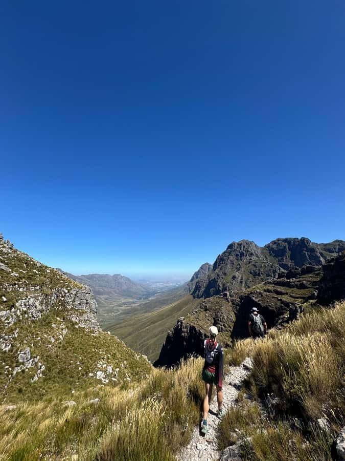
- 1,000 m of ascent over a 14 km circular route means steep efforts, not a casual stroll
- Small groups (up to 6) help you move at a human pace on rocky sections
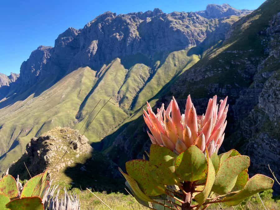
- Protea-covered slopes, grassy ridges, and craggy cliffs keep the scenery changing all day
- Berg River Saddle and Assegaibos Kloof Valley deliver some of the most dramatic “pause and stare” views
- Crystal-clear streams and waterfalls can add cool-off moments if you bring swimwear
- Strong fitness and good hiking shoes are non-negotiable here
Entering Jonkershoek: Why This Hike Feels Like a Real Mountain Day
Jonkershoek Nature Reserve sits in the Western Cape near Stellenbosch, and the Panorama Trail is one of the reserve’s star routes. What makes it satisfying is simple: you earn the views. There’s a steep push upward, then the landscape opens out into wide angles across the Jonkershoek valley and beyond.
I like hikes where the scenery doesn’t wait for the last hour. Here, you get changing habitats as you gain height—fynbos slopes give way to more rugged mountain terrain, with grassy ridges and rocky cliff faces along the way. One guide name you might hear around this route is Dominic, and the common thread is that the pace feels controlled, not chaotic.
The main “consideration” is mental as much as physical. If you don’t enjoy steep, uneven footing, or if you have a fear of heights, this route won’t be your friend. The good news is the hike is guided, and that guidance matters on terrain like this.
You can also read our reviews of more guided tours in Stellenbosch
Meeting at the Gate and Driving the 5 km Gravel Stretch
You meet at the Jonkershoek entrance gate. After a quick setup, you drive around 5 km on a gravel road into the valley where the trail starts. That short drive does two useful things for you: it positions the group close to the climb and it helps you get situated before the steep section begins.
You’ll also get a route and safety briefing before you start. On a hike that climbs over 1,000 m, that briefing is not formality. It’s your heads-up for rocky gully sections, pace control, and where you’ll likely need to slow down for footing.
Group size is limited to 6 participants, which keeps things calmer on narrow, rugged parts of the trail. You’re not fighting for space, and you can actually hear the guide when they explain the terrain.
The Rocky Gully Climb: Your 1,000 m Test of Grit
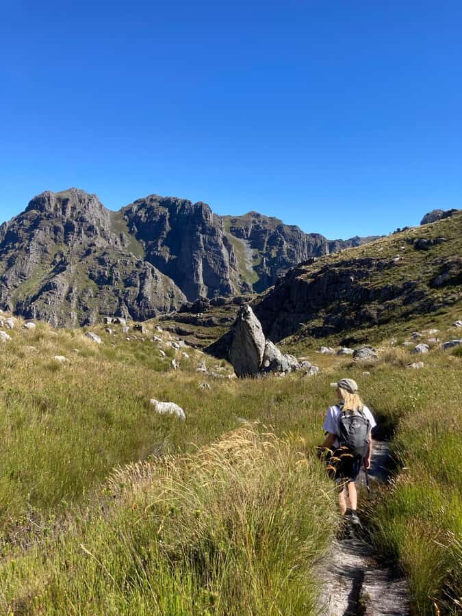
The Panorama Trail begins with a steady climb that turns into a steep, rugged ascent up a rocky gully. This is the part that separates “I hike sometimes” from “I’m ready for a mountain day.”
The hike gains over 1,000 meters of elevation relatively quickly compared with many other day hikes. That doesn’t mean you have to sprint. What you want is a consistent rhythm, and the guide sets that—often with regular rest stops. It’s a good way to avoid the classic mistake: going too hard early because the views look tempting.
Also, expect the ground to be uneven. You’ll be on rocky terrain, and that means good traction matters. If you show up in worn-out shoes or slick soles, you’ll spend extra energy just staying stable.
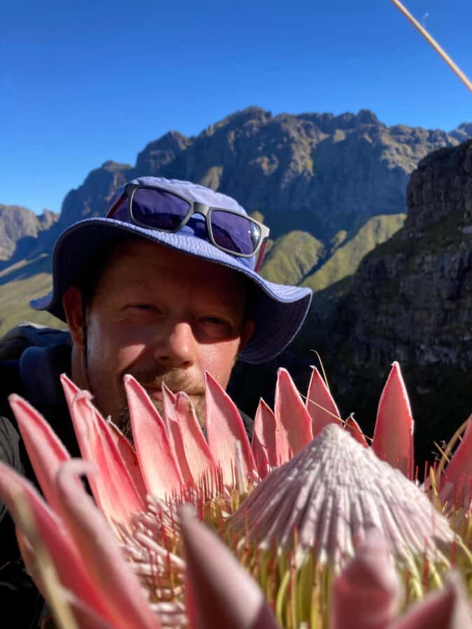
This climb is demanding, but it’s also where the payoff starts. Even during the ascent, you’re moving through the reserve’s changing plant zones—like protea-covered slopes—so it doesn’t feel like you’re just grinding toward nothing.
High Ridges and Panoramas: Where Every Stop Feels Worth It
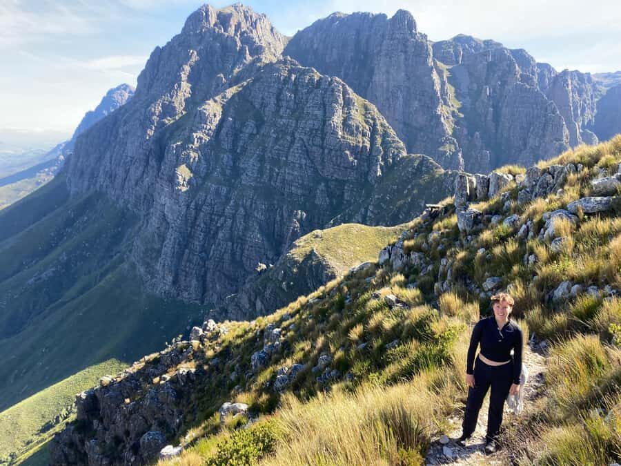
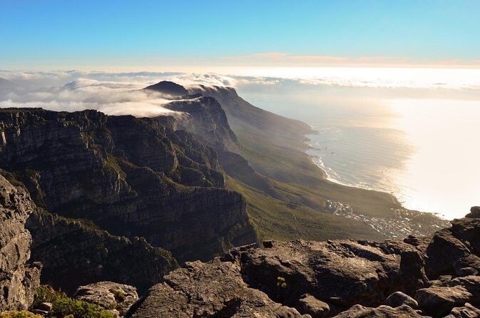
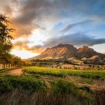
Once you reach the high ridge, the route opens up into sweeping panoramic views across the Stellenbosch mountains, the deep gorges, and broad fynbos-covered areas. This is the section where you’ll likely stop more often than you expect, because the scenery keeps unfolding as the trail curves and the angles widen.
I like that this isn’t one big viewpoint. The views are frequent. That matters because when you’re tired, you still get “mental rewards” along the way, not just at the top.
You’ll also see the variety that Cape hikers love: slopes with proteas, grassy ridges that feel wind-swept, and craggy cliff scenery that makes the mountains look close enough to touch. One neat theme from people who’ve done this route is that the flora changes constantly—fynbos, forest-like sections, and higher mountain habitat vibes all in the same day.
If you’re bringing a camera, this is where your battery and your patience should both be ready. The views are the kind you’ll want to capture more than once, from different angles.
Berg River Saddle and Assegaibos Kloof Valley Views
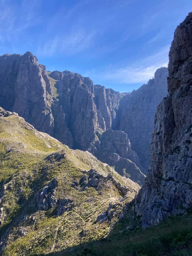
The descent is where the hike transforms from “climb mode” into “lookout mode.” You pass the Berg River Saddle, then the trail offers dramatic views into Assegaibos Kloof Valley, where the Berg River flows.
This is one of the hike’s standout moments because you’re getting depth: not just a faraway horizon, but a view into a valley system. That’s especially rewarding if you like photography or simply enjoy understanding where a river and mountain landscape connect.
There’s also a practical side. Downhill sections can be tough on knees, but being able to pause for views helps you regulate your pace. The guide will also help you keep control on rocky bits, which is a big deal when you’re tired.
And then the trail curves back toward the valley, completing a dramatic circular loop through one of the Cape’s impressive reserves.
You can also read our reviews of more hiking tours in Stellenbosch
Streams, Waterfalls, and When Swimwear Makes Sense
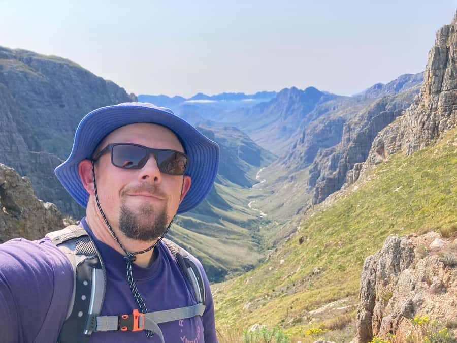
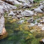
The hike includes the chance to see waterfalls and crystal clear streams. That’s not just nice-to-have. Clear water in a mountain reserve often means cooler micro-areas, and it can break up the dryness of a steep day.
Bring swimwear if you want the option. Even if you don’t plan to change into it, having it in your bag is useful for spontaneous dips when the guide points out the best stream spots. One participant specifically noted the water quality looked good enough for swimming, which aligns with what the hike offers: clear streams and creek-like sections where you can cool off.
Just remember the rules: no littering and no making fire. Keep it clean and leave the reserve as you found it.
The 14 km Circular Route: How to Think About Time and Effort
This is a 14 km circular hike. On paper, 14 km sounds manageable. In real life, the elevation gain and rocky terrain change the equation. Expect the hike to run about 5–6 hours, sometimes up to 7, depending on fitness, weather, and how often the group pauses for photos and views.
Here’s the mental model I recommend: treat the day as two phases. First is the hard work—steady climb turning into steep gully terrain. Second is the reward—ridges, saddle viewpoints, then descent back through the valley loop.
Because you’re guided, the pacing is adjusted. Still, you should show up ready for steep sections and a real elevation challenge. If you only like flat trails, you’ll likely find this draining rather than fun.
Price and Value: What $112 Covers (and What It Doesn’t)
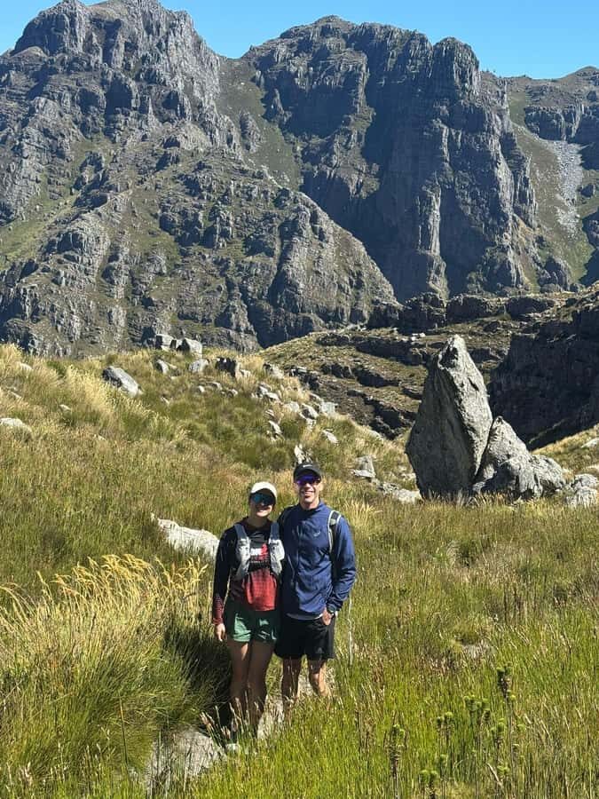
At $112 per person for about a six-hour hike, you’re paying for three things: an expert mountain guide, the reserve entrance fee, and a route that’s well suited to a small-group guided day.
What’s included:
- Expert mountain guide (English or German)
- Reserve entrance fee
- Mountain vistas, plus waterfalls and clear streams as part of the route experience
What’s not included:
- Transport to Jonkershoek Nature Reserve
- Drinks and snacks
So the value depends on how you’ll get there and how you prefer to handle food and water. If you’re driving yourself, the price feels more reasonable because you’re not paying extra for transfers. If you’re relying on others for transport, factor that cost into your planning.
I also like that the small group size keeps the day efficient. You get attention when you need it on rocky sections, and you’re not stuck behind slower hikers or rushed by faster ones.
What to Pack for This Strenuous Day Hike
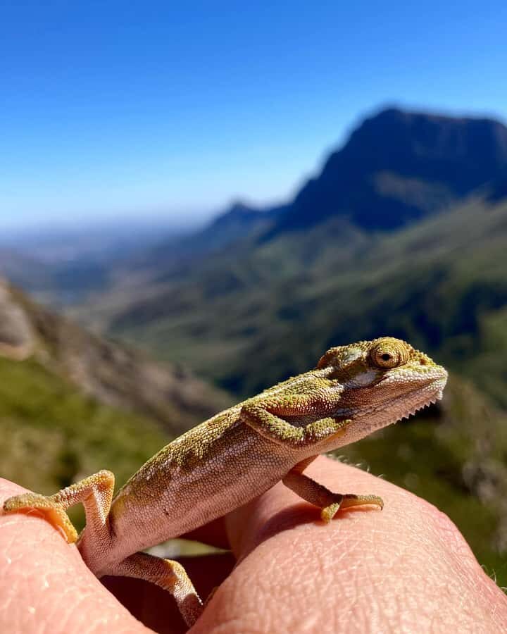
Bring gear that handles sun, cold mountain air, and rough ground.
Must-haves (based on what the hike expects):
- Hiking shoes (proper footwear)
- Water (min. 2.5 L)
- Sun hat and sunscreen
- Comfortable clothes you can move in
- Jacket (mountain weather can shift)
- Food (drinks/snacks are not included)
- Waterproof-ish plan if it’s damp, since the trail is rugged and rocky
Good add-ons:
- Swimwear, if you want the option to cool off in streams
- A charged camera battery, because the ridge and valley viewpoints will tempt you into extra stops
Also: smoking isn’t allowed, and neither is littering. Keep it tidy.
Who This Hike Fits Best (and Who Should Skip It)
This is for active travelers with a good fitness base. The route is strenuous, with steep sections, rocky terrain, and over 1,000 m elevation gain. The hike is also not suited for:
- children under 12
- people with mobility impairments
- people afraid of heights
- people with a low level of fitness
If you enjoy steep hikes and want the satisfaction of views that feel earned, this is a strong pick. If you prefer easy walks or mostly flat paths, you’ll probably feel underprepared.
The good part is that the guide will adjust the pace to keep you safe and comfortable. But that adjustment doesn’t remove the fundamental reality: you’re climbing hard and moving over rugged ground.
Should You Book This Guided Panorama Trail in Jonkershoek?
If you’re in the Stellenbosch area and you want one of the Cape’s standout day hikes, I’d book it with confidence—especially if you’re comfortable with a steep climb and want that top-to-bottom mountain scenery payoff. The small group size, the guided pace, and the mix of fynbos slopes, protea-covered areas, ridges, and big valley viewpoints make it feel like more than just a workout.
I’d think twice only if your fitness is low, you’re not steady on rocky trails, or heights make you anxious. For everyone else, it’s a classic “effort up front, views on repeat” mountain day.
If your schedule allows and the weather looks decent, this is the kind of hike you’ll remember long after you’ve left the trail.
FAQ
How long is the Jonkershoek Panorama Trail hike?
The duration is around 6 hours, with typical hiking time reported as about 5–6 hours, depending on fitness, pace, and weather conditions. The hike can run longer in some conditions.
How far is the route and how much elevation gain is there?
It’s a 14-kilometer circular route with over 1,000 meters of elevation gain, including a steep climb section up rugged terrain.
What group size is it, and what languages are the guides?
The hike is in a small group limited to 6 participants. Guides are available in English and German.
Where do we meet, and is transport included?
You meet at the gate of Jonkershoek Nature Reserve. The group then drives about 5 km on gravel to the start of the hike. Transport to the reserve is not included.
Is the entrance fee included?
Yes. The reserve entrance fee is included in the price.
Are drinks and snacks included?
No. Drinks and snacks are not included, so you should bring your own food and plan your hydration.
What fitness level do I need?
This is a strenuous hike with steep, rocky sections and more than 1,000 m of elevation gain. A good to strong fitness level is recommended.
If you’d like, tell me your current hiking comfort level (like your usual weekly distance and whether you handle steep rocky trails), and I’ll help you decide if this one fits.